Fóios and Mesas Mountain
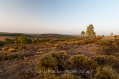
This small village in the municipality of Sabugal is located at the base of the western slope of the Mesas Mountain, at an average altitude of 950m. Its surroundings are formed of an interesting variety of natural and semi-natural environments, with meadows, oak woods, scrubland and pine forests. In addition, the presence of the narrow and timid course of the Côa River, which has its source here, at an altitude of almost 1200m, also stands out. The vestiges of human presence in this territory date back to the Bronze Age. In the recent past, this was also the territory of smugglers, who took advantage of the proximity of Spain and the mountainous area to smuggle products from both sides of the border. Currently, despite a smaller population, there is still an important farming activity, where cattle are preferred, giving rise, every year, to the traditional Capeia Arraiana.
The cradle of the Côa
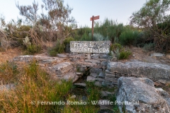
It is in this territory that one can find the source of the Côa River. In its initial stretch, it delimits the Natural Reserve of Serra da Malcata in its northern part. Until it reaches Sabugal, the Côa takes on a westerly orientation. As it goes around the historical town it turns North and continues until it flows into the left bank of the Douro River, after about 140km.
The walking circuit
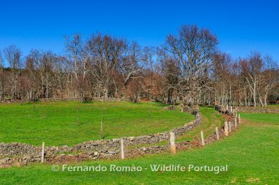
Mesas Mountain and the Cradle of the Côa is a circular trail that is located at the North of Malcata Mountain, starting and finishing in the central area of the village of Fóios. This area connects the Spanish border, being Navasfrías the nearest village. Next to the border, it makes use of an old smuggling route and, in its upper part, it includes a section of the Biodiversity Station installed here. The proposed route heads in an easterly direction, leaving the village when it crosses the Côa River. Following upstream, practically along its course, it passes through green meadows, oak woods and chestnut groves, separated by a grid of schist walls.
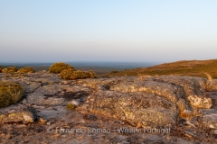
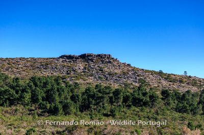
It goes up gradually until, at an altitude of about 1100m, the landscape begins to transform, as does its substratum, which changes from schist to granite. The slopes of the mountain are less wooded, with a greater presence of granite forms, and smaller shrubs. At an altitude of about 1175m, it reaches the source of the Côa River. It continues, climbing a little more until it reaches the cuminal plateau of the Mesas Mountain, passing close to its highest point, at 1256m. From here there are wide views to both Spanish and Portuguese territory. Continuing the crossing of the high part of the mountain, it continues along the border to the South, until it begins the long descent to Fóios, along the western slope. It goes through forested areas made up of pine and oak trees, as well as meadows.
The wildlife
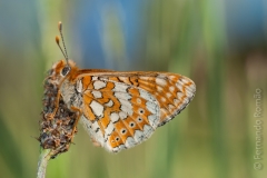
This mosaic is habitat to numerous species of carnivores such as the Wildcat (Felis sylvestris), the Red Fox (Vulpes vulpes), the Genet (Genetta genetta), the Weasel (Martes foina) or the Badger (Meles meles). Once occupied by the threatened Iberian Lynx, we can also find here the Roe Deer (Capreolus capreolus) and the Red Deer (Cervus elaphus).
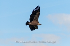
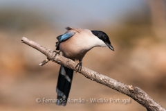
Birds are the most easily observed animals, with forest birds such as the Jay (Garrulus glandarius), the Nuthatch (Sitta europaea) and the Iberian Magpie (Cyanopica cooki) – an exclusive species to Portugal and Spain – standing out. However, it is common to see vultures, such as Griffon Vulture (Gyps fulvus) or Black Vulture (Aegypius monachus), flying over the region. On the upper plateaus of the Serra de Mesas, in its characteristic rocky and bushy habitat, we often hear, during spring, the melancholic call of the Ortolan Bunting (Emberiza hortulana), a small granivorous bird.
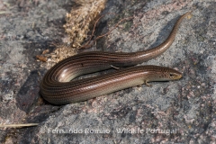
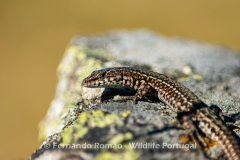
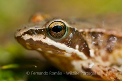
In the running water lines, or on their banks, we can find the Iberian Frog (Rana iberica) and the Schreiber’s Green Lizard (Lacerta schreiberi), two Iberian endemic species. Alongside these, we may come across with the Guadarrama’s Wall Lizard (Podarcis guadarramae), also an Iberian endemic species that prefers stony areas.
Botanical richness
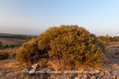
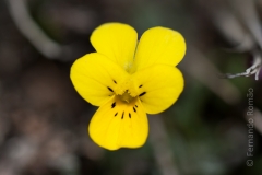
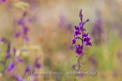
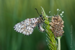
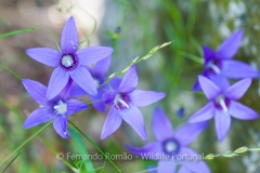
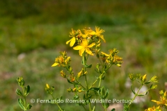
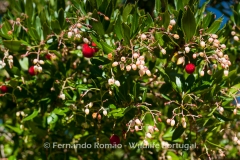
Along the course of the Mesas Mountain and the Cradle of the Côa, the landscape is composed of clusters of pyrenean oaks (Quercus pyrenaica), some well-developed chestnut trees (Castanea sativa), scrub and pine forests, interspersed with open areas in the lower areas, usually fresh meadows. This diversity of environments allows the occurrence of a great variety of plants, some of which have a distribution restricted to the Iberian Peninsula, such as the small and apparently fragile Yellow-violet (Viola langeana), the Hispidella hispanica, the pink-faced Veronica (Veronica micrantha), the Three Bird Toadflax (Linaria triornithophora), Linaria saxatilis, the White Broom (Cytisus multiflorus), the Echinospartum ibericum, among many others.
Geological heritage
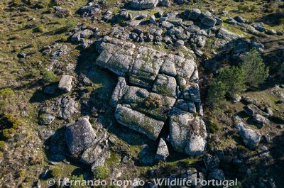
This is one of the most interesting thematics of this trail, since the Mesas Mountain, unlike the mountainous area where it is located, is formed by intrusive Hercynic granites. Here, the rocky outcrops have acquired very diverse forms, but the phenomena of perfect orthogonal fracturing that originated the so called “mesas” (tables) stand out. The different detailed geoforms that can be found here are also noteworthy, such as bolide stones, pedestal blocks, pedunculated blocks, split blocks, sinkholes, cannelures, polygonal fissures, pseudo-stratification, tors and also notable examples of spheroidal meteorization processes.
Length: 11,75 km
Type: circular
Duration: from 5 to 6 hours
Cumulative gap: 319m
Altitude max./min.: 1223m/922m
Recommended time of year: it can be done all year round. In summer, it is necessary to be careful because of the high temperatures. However, some parts of the trail are shaded by trees.
Recommendations and practical advice
For this activity, you will need comfortable footwear (preferably mountain boots or sports shoes), trousers, windbreaker and other clothing appropriate to the season and weather forecast. A hat for your head and sun cream. Bring water and individual food reinforcement (if justified) consisting, among others, of sandwiches, fruit or energy bars, nuts.
The planned programme may be subject to some changes should the weather conditions be too adverse.
FULL DAY: up to 4 participants – 155,00 €
For bigger groups and other conditions, contact us.
The price indicated includes guidance, transportation from Guarda and insurance.
Booking a place is only guaranteed if 50% of the registration fee is paid.
A discount equal to VAT is available for private clients.
VAT will be added to the indicated prices for companies and other entities.
Through the contacts available, indicating your name and cell phone contact/email.
The reservation is only guaranteed upon payment of 50% of the registration fee.
email: info@wildlifeportugal.pt
phone: +351 918 068 872


 English

